GIS Lab
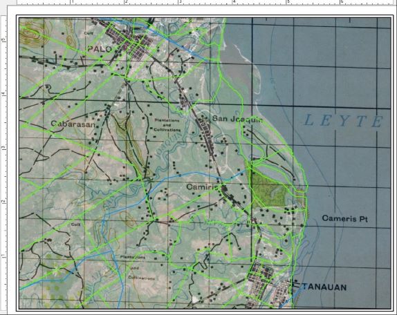
What is GIS? GIS, or Geographic Information Systems, allow us to store, manage, map, and analyze different types of spatial data. Related computer software allows us to overlay historical data from a specific case or region (e.g. World War II – Philippines) with aerial photography, satellite imagery, and geographic data layers. As part of CRIM’s GIS Lab, we use cutting-edge technologies in GIS, remote sensing, and geospatial analysis to support recovery efforts of MIA/POW service members.
As modern landscapes have dramatically changed over the past century, geospatial analysts at CRIM assist field project decision making through the analysis of both historic and modern geographic data.
The GIS Lab is managed by Dr. David Reid with partnerships with UIC, DPAA, and affiliated specialists.
Summary of GIS Heading link
GIS Lab Activities include:
- The curation of an interactive GIS database related to World War II spatial data from the Pacific, including historic airfields, temporary/field cemeteries, historic toponyms and settlements, and related MIA/POW case data.
- Map production relating to ground-losses and conflicts over spatial and temporal scales.
- Modeling potential search areas for missing World War II aircraft using historic flight-path data, eye-witness accounts, last-seen coordinates, aircraft flight speed/elevation, and local topography.
- Realtime geospatial support for investigation teams in the field.
Further Information or Links Heading link
-
Daley Library GIS Librarian